Antikythera
Greek island known for the ancient Antikythera mechanism discovery.

Antikythera (or Anticythera; in Greek, Antikýthira) sits at the edge of the Aegean Sea, between Crete and the Peloponnese. In ancient times it was called Aigilia. Since a 2011 administrative reform, it has been part of the municipality of Kythira. To its north lies the Kythira-Antikythira Strait, through which Mediterranean water flows into the Sea of Crete.
The island covers 20.43 square kilometers (7.89 square miles) and lies 38 kilometers (24 miles) southeast of Kythira. It is the most distant part of the Attica region from Athens. Lozenge-shaped, it stretches 10.5 kilometers (6.5 miles) from north-northwest to south-southeast and 3.4 kilometers (2.1 miles) from east-northeast to west-southwest. Its main settlement and port is Potamós (population 34 in 2011), with two other hamlets: Galanianá (15 people) and Charchalianá (19). The Ablemon Nautical Company ferry F/B Ionis periodically calls here on its route between Piraeus and Kissamos-Kastelli on Crete.
The earliest known inhabitants, from the 5th or 4th millennium BC, were likely seasonal hunters drawn by migratory birds. The population changed often as the island was settled and abandoned repeatedly, including a period of strong Cretan influence during the Bronze Age. In antiquity it was known as Aegilia, Aegila, or Ogylos. Between the 4th and 1st centuries BC, Cilician pirates used it as a base until Pompey the Great destroyed them; their fort still stands on a northeast cliff. The island’s archaeology has been fully surveyed, and the data are openly available.
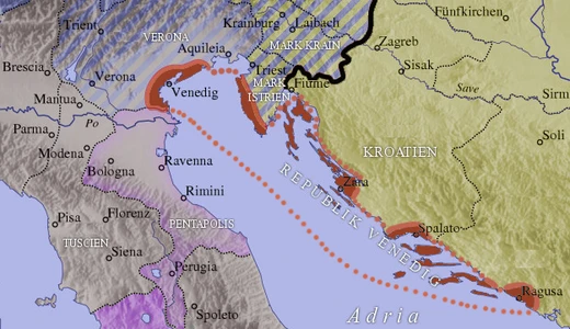
Antikythera experienced a complex history of rule: after the fall of Crete in 1669, the island remained under Venetian control as part of the Ionian Islands until the end of the Venetian Republic in 1797. It appeared on Ottoman maps as Küçük Çuha, a name still used in modern Turkish, but this reflected Ottoman cartographic claims rather than actual rule. Known as Cerigotto in Italian, it was part of the Venetian Ionian Islands after 1669. The Venetian Republic fell in 1797, after which the island passed to French control. In 1815 it became a British protectorate under the United States of the Ionian Islands, and was ceded to Greece by the Treaty of London in 1864. From 1864 to 1912, it was not the southernmost point of Greece—that title belonged to Cape Tenaro in the Peloponnese, as Crete and
- location
- Aegean Sea, between Crete and Peloponnese
- land_area
- 20.43 square kilometers (7.89 square miles)
- population
- 68 (2011 census, main settlements: Potamós 34, Galanianá 15, Charchalianá 19)
- ancient_name
- Aigilia (Αἰγιλία), also Aegila or Ogylos
- known_for
- Discovery of the Antikythera mechanism and Antikythera wreck
- notable_feature
- Largest breeding colony of Eleonora's falcon in the world
Lore & Background
The earliest known inhabitants of Antikythera were likely seasonal hunters from the 5th or 4th millennium BC. The population changed frequently, with periods of Cretan influence during the Bronze Age. Between the 4th and 1st centuries BC, Cilician pirates used the island as a base until their destruction by Pompey the Great; their fort remains atop a northeast cliff. After the fall of Crete in 1669, Antikythera remained under Venetian control as part of the Ionian Islands until the end of the Venetian Republic in 1797. It appeared on Ottoman maps as Küçük Çuha, but this reflected cartographic claims rather than actual rule. It was administered by the Venetians as part of the Ionian Islands after 1669.
Reader's Guide
Antikythera's significance stems primarily from the 1900 discovery of the Antikythera wreck, which yielded the Antikythera mechanism—an ancient mechanical calculator dated to about 205 BC, often described as the first mechanical computer. Technological artifacts of similar complexity did not reappear for a thousand years. The island also holds ecological importance as a critical stopover for migratory birds and hosts the world's largest breeding colony of Eleonora's falcon. The Antikythera Bird Observatory was established by the Hellenic Ornithological Society. A major Climate Observatory Center (PANGEA) is planned with €25 million in funding. The island's archaeology has been thoroughly surveyed, with data openly available. Notable person Andreas Anagnostakis (1826–1897) was a physician born there.
Did You Know?
- Antikythera was known in antiquity as Aigilia (Αἰγιλία).
- The island was never ruled by the Ottoman Empire, though it appeared on Ottoman maps as Küçük Çuha.
- It hosts the largest breeding colony of Eleonora's falcon in the world.
- The Antikythera mechanism, discovered in 1900, has been dated to about 205 BC.
Geography & Strategic Position
Nestled on the outer rim of the Aegean Sea, Antikythera occupies a slender lozenge of rock stretching roughly ten and a half kilometres from north-northwest to south-southeast and just over three kilometres across its shorter axis. With a total land area of barely twenty square kilometres, it sits thirty-eight kilometres to the south-east of its larger neighbour Kythira, and since the 2011 local government reorganisation it has been folded into Kythira's municipality. The island is, in administrative terms, the farthest outpost of the Attica region, stretching well beyond the Athens metropolitan heartland. To its north, the Kythira-Antikythira Strait funnels Mediterranean waters into the Sea of Crete, giving the tiny landmass a quietly strategic hydrographic role. Human presence remains minimal: the principal harbour village of Potamós was home to only thirty-four residents at the 2011 census, with the hamlets of Galanianá and Charchalianá adding a further thirty-four souls between them. The Ablemon Nautical Company's ferry, the F/B Ionis, links the island to Piraeus and to Kissamos-Kastelli on Crete, reminding visitors that this remote speck still belongs to the modern Greek world.
The Wreck and the Ancient Calculator
In 1900, divers working the waters around Antikythera stumbled upon a Roman-era shipwreck that would reshape our understanding of ancient technology. Among the cargo hauled from the seabed were the remarkably preserved statue known as the Antikythera Ephebe and, more astonishingly, a complex bronze device now called the Antikythera mechanism. Dated to roughly 205 BC, this artefact functioned as a mechanical calculator engineered to predict and display the positions of celestial bodies. Scholars have sometimes described it as the first mechanical computer, a label that captures its extraordinary ambition for the era. What makes the find so staggering is the gap it left in the technological record: no object of comparable mechanical sophistication surfaced again for approximately a thousand years. The wreck and its contents remain the island's most celebrated claim to fame, drawing researchers and the curious to these waters on the edge of the Aegean.
A History of Rival Powers and Resilience
The human story of Antikythera stretches back to the fifth or fourth millennium BC, when seasonal hunters likely visited to exploit passing migratory birds. Over the centuries the population came and went repeatedly, and during the Bronze Age the island absorbed a noticeable wave of Cretan cultural influence. In antiquity it bore several names—Aegilia, Aigila, Ogylos—reflecting shifting identities. From the fourth through the first centuries BC, a band of Cilician pirates made the island their base, leaving a fort on a north-eastern cliff that still stands; Pompey the Great ultimately destroyed the pirates. Remarkably, Antikythera escaped Ottoman rule entirely, the empire apparently deeming the small island not worth conquering, though it appeared on Ottoman charts as Küçük Çuha. The Venetians claimed it as part of their Ionian Islands administration despite its great distance from the main archipelago, holding out until 1800—three years after the rest of the Ionian group fell to Napoleonic France. After a stint as a British protectorate within the United States of the Ionian Islands, the island was ceded to Greece in 1864. Between that year and 1912, while Crete remained under Ottoman sovereignty, Antikythera was the southernmost point of the Greek state.
Living Heritage and the Science of the Sky
Beyond its archaeological fame, Antikythera plays a vital role in the natural world. Its elongated north-south orientation and remarkably low human footprint make it an exceptional stopover for migratory birds during their seasonal flights. The island is home to the largest breeding colony of Eleonora's falcon anywhere on Earth, and its associated islets have been designated an Important Bird Area by BirdLife International. Recognising the site's value for studying avian migration, the Hellenic Ornithological Society established the Antikythera Bird Observatory, a dedicated research station that continues to monitor the migratory populations passing through. Wild goats roam the island in significant numbers, adding to the sense of a landscape largely untouched by intensive development. Looking ahead, a €25 million project backed by the European Investment Bank, the National Observatory of Athens, the local municipality, and other partners, with additional support from Cosmote and the Niarchos Foundation, is set to install one of Europe's largest Climate Observatory Centres on the island, ensuring that Antikythera's scientific significance extends well beyond its ancient past.
Frequently Asked Questions
Where exactly is Antikythera situated?
It is a small island in the Aegean Sea, positioned between Crete and the Peloponnese, roughly 38 kilometers southeast of Kythira. The Kythira-Antikythira Strait runs to its north, channeling Mediterranean water into the Sea of Crete.
What is Antikythera most famous for?
The island is best known as the site where the extraordinary Antikythera mechanism was recovered from an ancient shipwreck. It also shelters the world's largest breeding colony of Eleonora's falcon.
How many people live on Antikythera and where do they settle?
The 2011 census recorded only 68 residents spread across three tiny villages: Potamós with 34 inhabitants, Charchalianá with 19, and Galanianá with 15. It remains one of the most sparsely populated places in the region.
What was the island called in antiquity?
Ancient sources refer to it as Aigilia, a name sometimes rendered in Latin as Aegila or Ogylos. The modern Greek form, Antikýthira, replaced that older designation over time.
What does the island look like in terms of size and shape?
Antikythera is a compact, lozenge-shaped landmass covering about 20.43 square kilometers and stretching roughly 10.5 kilometers at its longest axis. It is the point in the Attica region farthest from Athens.
More in Territories of the Republic of Venice 1-24
Spotted an error? Know more?
This is a living reference — every entry is fact-audited, and reader corrections feed straight into our audit queue. Suggest an edit · See this site's audit record